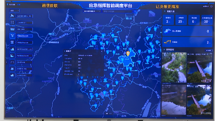
As China navigates its critical peak flood season, typically from late July to mid-August, the nation is intensifying its reliance on cutting-edge technological advancements, particularly in the domain of artificial intelligence (AI), to fortify its flood control and prevention mechanisms. This strategic integration is transforming traditional approaches to water resource management and disaster preparedness. AI systems are now playing an indispensable role in providing granular, real-time insights into fluctuating water levels across expansive river networks and reservoirs. Crucially, these intelligent platforms are also enhancing the accuracy and speed of flood prediction, allowing for a proactive rather than reactive stance against potential environmental catastrophes. The importance of this shift cannot be overstated, as effective flood control is vital for protecting millions of citizens, safeguarding agricultural lands, and preserving critical infrastructure. This initiative reflects China's broader commitment to leveraging digital innovation for national resilience, ensuring that sophisticated algorithms and data analytics are at the heart of its efforts to mitigate the devastating impact of seasonal deluges. The following report by You Yang meticulously details how these advanced AI technologies are fundamentally reshaping the landscape of flood control in China, making significant strides toward a more secure and technologically empowered future in disaster management.
AI's Transformative Role in Hydrological Monitoring and Prediction
The implementation of artificial intelligence marks a paradigm shift in China's flood management strategy, significantly boosting capabilities in both real-time hydrological monitoring and advanced predictive modeling. Traditionally, flood forecasting was often labor-intensive and limited by the volume and velocity of data that could be processed manually. However, AI-driven solutions are now capable of continuously collecting, analyzing, and interpreting vast datasets sourced from an intricate network of remote sensing technologies, including satellite imagery, drones, and an array of ground-based sensors deployed across rivers, lakes, and coastal areas. This comprehensive data aggregation facilitates the early detection of anomalies and patterns that signify impending flood risks. Machine learning algorithms, trained on decades of historical weather data, hydrological patterns, and previous flood events, can generate remarkably accurate forecasts for water flow, potential overflow areas, and the timing and severity of flood peaks. This predictive power is invaluable, providing authorities with sufficient lead time to issue early warnings, coordinate evacuations, deploy emergency resources, and implement preventative measures like adjusting reservoir discharges or reinforcing flood barriers. Beyond prediction, AI also supports operational flood control by optimizing the management of complex water conservancy projects. It can intelligently adjust the operations of dams and sluice gates to maximize flood retention or strategically release water to prevent downstream crises, all while balancing agricultural, industrial, and ecological needs. This sophisticated, data-driven approach not only minimizes the physical and economic damage caused by floods but also enhances the overall safety and resilience of communities nationwide, demonstrating AI's profound and multi-faceted impact on national security and environmental protection.